Description
US Wind holds the lease rights to a federal lease area with the western edge located approximately 16.2 km to the closest point on the Maryland coastline. The lease area, about 80,000 acres in size, has a capacity for US Wind’s contracted projects of about 1,710 megawatts (MW) of offshore wind energy, which is enough clean electricity to power 600,000 homes while displacing 4 million tons of CO2 every year.
The Maryland Offshore Wind Project is likely to be built in multiple construction campaigns. The first will be MarWin consisting of approximately 400 MW generating approximately 1.6 million megawatt-hours (MWh) per year. The following phases, totaling 1.3 GW for Momentum Wind, would be built out over the subsequent years (early 2030’s). Once fully built out, electricity from the lease area would total nearly 7 million MWh every year.
The full buildout of the Maryland Offshore Wind Project within the federal lease area would include 114 WTGs, four offshore substations and one meteorological tower. The project will be interconnected by up to four (4) 230-275 kV export cables into US Wind onshore substations adjacent to the Indian River Power Plant in Dagsboro, Delaware.
Location
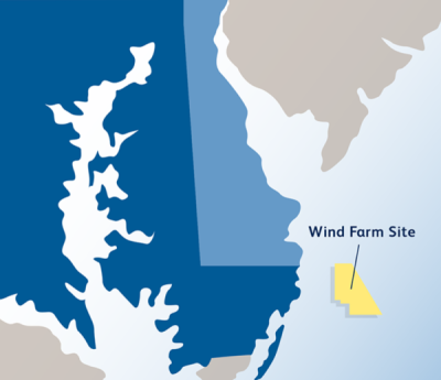
The Project will be located approximately 16.2 km from the Maryland coastline. It will have an installation base in Baltimore, Maryland and a grid connection point near the Indian River power plant in Dagsboro, Delaware (USA).
Project Timeline
- 2025, January: Maryland Offtake Re-bid Conditionally Secured (MarWin and Momentum Phases)
- 2024, December: BOEM Approves COP
- 2024, September: BOEM Announces Record of Decision
- 2024, July: Final Environmental Impact Statement Available
- 2023, September: Draft Environmental Impact Statement Available
- 2022, June: Section 106 Review/Consultation with SHPO/THPO Initiated
- 2021, December: Maryland Offtake Conditionally Secured (Momentum)
- 2021, May: BOEM Site Assessment Plan (SAP) Approved
- 2020, August: COP Submitted
- 2017, May: Maryland Offtake Conditionally Secured (MarWin)
- 2016, January: BOEM Site Assessment Plan (SAP) Submitted
- 2015, August: Initial Interconnection Request Submitted
- 2014, August: Site Exclusivity Obtained
- 2014, July: BOEM Final Sale Notice (FSN) Issued
Licensing Information
Construction and Operations Plan (COP)
- COP submitted to BOEM August 2020
- BOEM approves COP December 2024
National Environmental Policy Act (NEPA) review
- BOEM Notice of Intent to prepare an Environmental Impact Statement (EIS) posted in Federal Register June 2022
- BOEM Draft EIS issued September 2023
- Maryland Department of the Environment (MDE)/Maryland Department of Natural Resources (MDNR) federal consistency concurrence with Maryland enforceable coastal policies issued under Subpart E of the Coastal Zone Management Act (CZMA) in support of BOEM’s COP and EIS July 2024
- Delaware Department of Natural Resources and Environmental Control (DNREC) issued conditional concurrence under Subpart E of the CZMA that BOEM’s COP and EIS for the US Wind project is consistent with DNREC’s Delaware Coastal Zone Management Program (DCMP) enforceable policies July 2024
- BOEM Final EIS issued July 2024
- BOEM issues Record of Decision (ROD) September 2024
Section 10 Rivers and Harbors Act/Section 404 Clean Water Act
- United States Army Corps of Engineers (USACE) Individual Permit Section (10/404) application submitted August 2023
- Joint Federal/State Application for the Alteration of Any Tidal Wetland in Maryland submitted to MDE August 2023
- Water Quality Certification (per Clean Water Act Section 401) request submitted to MDE February 2024
- Water Quality Certification request submitted to DNREC April 2024
- MDE Water Quality Certification issued July 2024
- MDE/ MDNR Conditional federal consistency with Maryland enforceable coastal policies issued under Subpart D of the CZMA in support of USACE Section10/404 permit July 2024
- DNREC issued conditional concurrence under Subpart D of the CZMA that the USACE’s Section 10/404 permit for the US Wind Project is consistent with DNREC’s DCMP enforceable policies July 2024
- DNREC Water Quality Certification issued October 2024
- Maryland Tidal Wetlands License issued by the Maryland Board of Public Works November 2024
- USACE Individual Permit (10/404) issued January 2025
Section 408 Permit Permission-Civil Works Projects
- USACE Section 408 application submitted August 2023
- USACE Section 408 Permit Permission issued January 2025
National Historic Preservation Act (NHPA) Section 106 Consultation
- BOEM initiates Section 106 consultation with State Historic Preservation Offices/Tribal Historic Preservation Offices June 2022
- BOEM Final Section 106 Memorandum of Agreement with Consulting Parties August 2024
Marine Mammal Protection Act - Incidental Take Request/Letter of Authorization (LOA)
- National Marine Fisheries Service (NMFS) LOA deemed complete April 2023
- NMFS publication of Draft Rule in Federal Register for LOA January 2024
- NMFS publication of Final Rule in Federal Register for LOA October 2024
- NMFS LOA issued November 2024
Magnuson-Stevens Fishery Conservation and Management Act-Essential Fish Habitat Consultation
- NMFS Essential Fish Habitat (EFH) Consultation Request submitted by BOEM June 2023
- NMFS EFH Conservation Recommendations issued May 2024
Endangered Species Act Section 7 Consultation
- NMFS Section 7 Endangered Species Act (ESA) Consultation Request submitted by BOEM June 2023
- United States Fish and Wildlife Service (USFWS) Section 7 ESA Consultation Request submitted by BOEM June 2023
- USFWS Section 7 ESA BiOp issued May 2024
- NMFS Section 7 ESA Biological Opinion (BiOp) issued June 2024
Obstruction Evaluation/Airport Airspace Analysis (OE/AAA)-Determination of No Hazard
- OE/AAA filed with Federal Aviation Administration (FAA) October 2022
- FAA Determination of No Hazard (DNH) received May 2023
- FAA DNH Extension granted January 2025
Outer Continental Shelf Clean Air Act Permit
- Outer Continental Shelf (OCS) Clean Air Act Air Permit Application submitted to Maryland Department of the Environment (MDE) August 2023
- MDE Final OCS Clean Air Act Permit to Construct, New Source Review Approval, and Prevention of Significant Deterioration Approval issued June 2025
DNREC Wetlands Permit
- Wetlands Permit Application submitted to DNREC February 2024
- Wetlands Permit approved December 2024
DNREC Subaqueous Lands Permit and Lease
- Subaqueous Lands Permit and Lease Application submitted to DNREC February 2024
- Subaqueous Lands Permit and Lease approved December 2024
DNREC Beach Preservation Coastal Construction Permit
- Beach Preservation Coastal Construction Permit Application submitted to DNREC February 2024
- Beach Preservation Coastal Construction Permit approved December 2024
DNREC Division of Parks and Recreation Special Use Permit for underground utilities through State park
- DNREC issued Beach lease January 2025
Key Environmental Issues
Careful siting of the offshore wind lease area avoids many environmental issues related to the Maryland Offshore Wind Project.
- The seabed within US Wind’s lease area is primarily comprised of soft sandy bottom areas.
- Commercial fishing largely occurs elsewhere, as demonstrated through revenue of less than $200,000 annually on average from the lease area. Fishing would continue throughout the lease area and the reef effect related to the increased underwater structure is likely to attract numerous fish.
- Few bats have been detected in the lease area, and the relatively low numbers of birds are species that would not be flying at heights to interact with the wind turbines.
Notwithstanding the generally minor potential impacts, US Wind proposed extensive mitigation measures to further avoid and minimize impacts to environmental resources and marine wildlife through the development of the Maryland Offshore Wind Project. These mitigation measures are now incorporated in the comprehensive permits and approvals issued for its Project.
US Wind conducts wildlife studies and surveys to supplement and complement existing research by agencies and academic institutions like the Bureau of Ocean Energy Management, University of Maryland Center for Environmental Science, and Maryland Department of Natural Resources.
For example, US Wind recently partnered with University of Maryland Center for Environmental Science (UMCES) on two efforts to further understand whale presence in the Lease area and potential impacts. These include a real-time whale detection system to provide timely alerts on the presence of baleen whales (North Atlantic right whales, and humpback, fin and sei whales) using specialized quiet mooring technology, whale vocalization detection algorithms, and telecommunications to transmit frequent alerts on the presence of baleen whales. A Passive Acoustic Monitoring (PAM) Array will also utilize two types of listening devices to determine the presence and migration patterns of large whales, dolphins, and porpoises. In addition, UMCES has commenced commercial fisheries resource monitoring survey work focused on the economically important black sea bass fishery as well as a recreational fishery resource monitoring survey. More information on the UMCES research and monitoring efforts can be found on the UMCES’ Tailwinds web page.
US Wind is also conducting an additional avian monitoring program to confirm earlier conclusions about risks and potential impacts. The avian monitoring program is comprised of data collection from sensors on the Metocean Buoy deployed by US Wind in May 2021 through May 2024, as well as pre- and post-construction aerial surveys over the Lease area, including a 10-kilometer buffer.
US Wind has released fact sheets with additional information on how they plan to protect marine mammals, wildlife, and birds before, during, and after construction.
Environmental Papers and Reports
- Conditions of Construction and Operations Plan Approval (Bureau of Ocean Energy Management (BOEM) 2024)
- Maryland Offshore Wind Final Environmental Impact Statement (EIS) (Bureau of Ocean Energy Management (BOEM) 2024)
- National Marine Fisheries Service Biological Opinion (National Marine Fisheries Service (NMFS) 2024)
- U.S. Fish and Wildlife Service Biological Opinion (US Fish and Wildlife Service (USFWS) 2024)
- Bat and Bird Data Analysis and Results Summary May 2021 to May 2023 Final Report (Normandeau Associates Inc 2024)
- An Eulerian perspective on habitat models of striped bass occurrence in an offshore wind development area (Rothermel et al. 2024)
- Ornithological and Marine Fauna Aerial Digital Survey: First Annual Report (Normandeau Associates Inc 2023)
- Maryland Offshore Wind Draft Environmental Impact Statement (DEIS) (BOEM Office of Renewable Energy Programs 2023)
- Maryland Offshore Wind Construction and Operations Plan (TRC 2023)
- Bat and Bird Data Analysis and Results Summary: Progress Report #5 (Normandeau Associates Inc 2023)
- Maryland Offshore Wind Construction and Operations Plan: Appendix II E1 - Essential Fish Habitat Assessment (TRC 2023)
- Offshore Electric and Magnetic Field Assessment (Exponent Inc. 2023)
- Ornithological and Marine Fauna Aerial Digital Survey: First Semiannual Report (Normandeau Associates Inc 2023)
- Bat and Bird Data Analysis and Results Summary May 2021 to May 2022 Progress Report #4 (Final) (Normandeau Associates Inc 2023)
- Offshore Bat Monitoring and Detections (ESS Group 2022)
- Bat and Bird Data Analysis and Results Summary: Progress Report #2 & 3 (Normandeau Associates Inc 2022)
- Maryland Offshore Wind Public Scoping Report (BOEM Office of Renewable Energy Programs 2022)
- Maryland Offshore Wind Construction and Operations Plan: Appendix II H1 - Underwater Acoustic Assessment (Marine Acoustics 2022)
- Maryland Offshore Wind Construction and Operations Plan: Appendix II N2 - Avian Monitoring Plan (Normandeau Associates Inc 2022)
- Bat and Bird Data Analysis and Results Summary: Progress Report #1 (Normandeau Associates Inc 2022)
- Maryland Offshore Wind Construction and Operations Plan: Appendix II N1 - Avian Risk Assessment (ESS Group 2021)
- Maryland Offshore Wind Construction and Operations Plan: Appendix II F2 - Fisheries Assessment Report (Sea Risk Solutions 2021)
- Maryland Offshore Wind Construction and Operations Plan: Appendix II F1 - Fisheries Communication Plan (Sea Risk Solutions 2021)
- Identifying and predicting occurrence and abundance of a vocal animal species based on individually specific calls (Bailey et al. 2021)
- Diurnal vertical movements in black sea bass (Centropristis striata): Endogenous, facultative, or something else? (Secor et al. 2021)
- The recurring impact of storm disturbance on black sea bass (Centropristis striata) movement behaviors in the Mid-Atlantic Bight (Wiernicki et al. 2020)
- Identifying Important Juvenile Dusky Shark Habitat in the Northwest Atlantic Ocean Using Acoustic Telemetry and Spatial Modeling (Bangley et al. 2020)
- Comparative migration ecology of striped bass and Atlantic sturgeon in the US Southern mid-Atlantic bight flyway (Rothermel et al. 2020)
- Movement and Habitat Selection by Migratory Fishes within the Maryland Wind Energy Area and Adjacent Reference Sites (Secor et al. 2020)
- Maryland Offshore Wind Construction and Operations Plan: Appendix II D1-Indian River Bay Benthic Report (ESS Group 2019)
- Maryland Offshore Wind Construction and Operations Plan: Appendix II D2- Offshore Benthic Report (ESS Group 2019)
- Determining Habitat Use by Marine Mammals and Ambient Noise Levels Using Passive Acoustic Monitoring Offshore of Maryland (Bailey et al. 2018)
- Year-Round Spatiotemporal Distribution of Harbour Porpoises Within and Around the Maryland Wind Energy Area (Wingfield et al. 2017)
- Maryland Offshore Wind Construction and Operations Plan: Appendix II D3- SAP Area Benthic Assessment Report (ESS Group 2015)
- Marine Mammal and Sea Turtle Sightings in the Vicinity of the Maryland Wind Energy Area July 2013-June 2015 (Barco et al. 2015)
NOAA Fisheries has developed Offshore Wind Lease Reports that summarize previous fishing activity within each offshore wind lease area along the U.S. Atlantic Coast. View Descriptions of Selected Fishery Landings and Estimates of Vessel Revenue from Areas: A Planning-level Assessment and Descriptions of Selected Fishery Landings and Estimates of Recreational Party and Charter Vessel Revenue from Areas: A Planning-level Assessment for Maryland Offshore Wind (MarWin) (OCS-A-0490) here.
Environmental Monitoring: Maryland Offshore Wind (MarWin)
| Phase | Stressor & Receptor | Design and Methods | Results | Publications | Data |
|---|---|---|---|---|---|
| Baseline | Birds | Bird Survey In 2019, the Department of Natural Resources and Environmental Control began colonial nesting waterbird surveys in Rehoboth Bay. Locations for the surveys were selected based on historic breeding records for species of the greatest conservation need. Surveyors counted birds, including laughing gulls, herring gulls, great black-backed gulls, great egrets and Forster’s tern, from the water using spotting scopes or binoculars between April – September. | Complete The results suggest that wading birds, saltmarsh perching birds, and birds of prey that may overwinter in the US Wind project area may potentially be impacted by activities that are scheduled to occur in winter months. | TRC 2023 | No data publicly available |
| Baseline | Birds | Bird Assessment The assessment of geographic and behavioral exposure relied on data from a project conducted between 2012 and 2014. To supplement these surveys, an expansion of the study area in 2013 to collect additional baseline data on wildlife abundance and distribution in and around the Maryland wind energy area. | Complete The surveys resulted in thousands of observations of dozens of avian species over the two-year study period. Species with seasonal occurrence in the project area which were found to have the highest risk of geographic, behavioral, and displacement exposure due to the project were: alcids, gannets, grebes, gulls and terns, jaegers and skuas, loons, sea ducks, shearwaters and fulmars, and storm-petrels. | ESS Group 2021 | No data publicly available |
| Baseline | Cetaceans | Marine Mammal Survey Three years of passive acoustic monitoring (PAM) data were collected 12–60 km offshore of Maryland Wind Energy Area (WEA). Various recorders were deployed in different array configurations to detect low-frequency baleen whales (13 sites) and high-frequency odontocetes (12 sites). Additional recordings during select periods were used to assess mid-frequency odontocetes (5 sites). Ambient noise levels were also assessed. | Complete Fin whales were most frequently detected but offshore of the WEA. Humpback whales were mainly detected within and offshore. Minke whales were rarely detected. North Atlantic right whales were detected every month, but mainly Nov to Apr as they migrated through and offshore of the WEA. Bottlenose dolphins (at least 700 individuals based on signature whistles) were detected every month within and inshore of the WEA except Feb. Offshore detections occurred summer and fall. Common dolphins were detected offshore December to May. Harbor porpoises were detected November to June, however their habitat shifted from offshore to inshore of the WEA halfway through the study. The eastern edge and offshore of the WEA had the loudest ambient noise levels, mainly attributed to shipping noise. Dolphin whistles also contributed to increased ambient noise levels. | Bailey et al. 2018 | No data publicly available |
| Baseline | Fish | Finfish and Essential Fish Habitat (EFH) Surveys US Wind deployed a buoy within the lease area for a planned 2-year metocean data collection campaign during the site assessment term of the lease. The buoy and its associated seabed mounted Trawl Resistant Bottom Mount (TRBM) are equipped with a suite of wildlife monitoring sensors. This includes a fish telemetry receiver within the TRBM that records detections of previously tagged fish species within the lease area. | Ongoing Bottom trawl surveys between 2003-2012 demonstrated a large seasonal shift in demersal species. Catches in the fall (September to October) primarily consisted of seasonally migratory species including Atlantic croaker, weakfish, spot, and northern sea robin. Spring catches (March) were dominated by little skate, smallmouth flounder, and spotted hake. Results of 2016-2018 tri-annular trawl surveys showed that Atlantic sturgeon occurred extensively in the lease area. | TRC 2023, TRC 2023 | No data publicly available |
| Baseline | Fish | Fish Survey From Nov 2016 to Dec 2018, 20 acoustic-release receivers were deployed in the Maryland Wind Energy Area (WEA). More than 500 striped bass were implanted with active transmitters (associated with other research programs) and an additional 40 were implanted with depth transponders to evaluate depth behaviors. More than 1,000 Atlantic sturgeon were implanted with active transmitters (associated with other research programs). Environmental data was recorded from receiver-logged bottom temperature and noise levels and from passive acoustic buoys and remote sensing platforms. A before-after-gradient design was used to model presence against gradients of depth, temperature, and other oceanographic variables. | Complete Seasonal presence suggests the WEA lies within migration corridors for Atlantic sturgeon and striped bass. Atlantic sturgeon were detected fall through early winter and spring through early summer at mid-range depths during fall and shallower depths in spring. Striped bass occurrence was more concentrated and in deeper areas during winter months and broadly utilized cross-shelf regions during spring. Both species were strongly associated with cross-shelf depths and environmental gradients rather than specific seabed characteristics. Temperature was a strong driver of striped bass presence whereas Atlantic sturgeon showed broader temperature tolerance. Striped bass had a longer resident time in winter. Summer-time wind turbine construction would minimize interactions with both test species. During fall, winter, and spring striped bass distributions centered within the footprint of the WEA, whereas Atlantic sturgeon would overlap with inshore transmission lines. | Secor et al. 2020 | No data publicly available |
| Baseline | Invertebrates | Benthic Surveys A survey of benthic resources (focused on six locations within the US Wind project area) was conducted in July 2015, September 2016, and October 2017. The benthic field survey was composed of two elements, including 1) collection of still images and video of the seafloor and 2) collection of benthic grab samples for laboratory analysis of taxonomic composition. | Complete 2016 benthic imagery obtained indicated the presence of at least eight macrofaunal taxa: sea stars, rock crabs, tube anemones, sand dollars, hydrozoans, moon snails, hermit crabs, and bristle worms. In 2015 grab samples nineteen species of benthic fauna were observed. | TRC 2023, ESS Group 2019, ESS Group 2019, ESS Group 2015 | No data publicly available |
| Baseline | Marine Mammals | Marine Mammal Surveys HD digital aerial surveys and boat-based surveys were conducted between 2012 and 2014 across a 13,245 square km study area off the coasts of Delaware, Maryland, and Virginia. Observer based aerial surveys were conducted monthly between 2013 and 2015. An ambient noise level study was conducted between November 2014 and January 2017. | Ongoing The following marine mammal species were found to be common within the project area: North Atlantic right whale, fin whale, humpback whale, minke whale, bottlenose dolphin, and short-beaked common dolphin. | TRC 2023 | No data publicly available |
| Baseline | Reptiles, Sea Turtles | Sea Turtle Survey HD digital aerial and boat-based surveys were conducted in the US Wind project area between 2012 and 2014. Observer based aerial surveys were conducted monthly between 2013 and 2015. US Wind conducted preliminary geotechnical and geophysical surveys within the lease area in 2015-2017. | Complete The following sea turtle species were found to be common within the project area: loggerhead turtle and leatherback turtle. | TRC 2023 | No data publicly available |
| Construction | Collision Bats |
Bat Monitoring Plan
US Wind deployed a buoy within the lease area for a planned 2-year metocean data collection campaign during the site assessment term of the lease. The buoy is equipped with a bat acoustic sensor which monitors the nocturnal calls of migrating bat species. The Department of Natural Resources and Environmental Control collected acoustic data in the Indian River Bay area between 2019 and 2021 during the summer breeding season. |
Ongoing
Acoustic surveys between 2019-2021 estimated a 90-100% likelihood that Myotis were present in 2020. Recent studies indicated twelve presumed eastern red bats via visual observation in the month of September off the coast of New Jersey, Delaware, and Virginia. Buoy data will be used to assess the presence of bats within the lease area. |
TRC 2023 | No data publicly available |
| Construction | Collision Bats |
Vessel-Based Acoustic Bat Survey Opportunistic bat monitoring occurred during high resolution geophysical (HRG) and geotechnical surveys of the Lease area. An Anabat Swift bat detector was deployed Mar 2021 to Oct 2021 and Dec 2021-Apr 2022. An Emma Anabat Swift was deployed Apr 2021 to Nov 2021. Echolocation data was used to identify species. Distance to shore and seasonality of bat activity was assessed in three areas relative to bat activity: in port, offshore, and in Lease area. | Complete The survey recorded 148 bat detections, 65% of which were identified to species. The most common any distance from shore was the Eastern Red Bat. As distance from shore increased, detections and species diversity decreased. The highest bat diversity and detections were in port. The Eastern Red Bat was the only species 18 mi offshore. Number of detections remained relatively consistent 5 to 20 miles from shore and were rare beyond 20 miles. Only 9% of detections occurred within the Lease area. Peak bat activity occurred in August, as bat migration increased on the Atlantic coastline. | ESS Group 2022 | No data publicly available |
| Construction | Collision Bats, Birds |
Floating Buoy-Based Acoustic Bat and Bird Survey
A SM4 Bat acoustic detector was deployed on a floating buoy deployed by US Wind from May 2021 to May 2023. The detector was operational for 274 days in Year 1 and 184 days in Year 2. The detector recorded from an hour before sunset to an hour after sunrise. Acoustic data were analyzed with bat acoustic identification software SonoBat and Kaleidoscope. Non-bat high-frequency recordings were removed following the use of the SonoBat automated identification classifier. A SM4 Bird acoustic detector was deployed on a floating buoy deployed by US Wind from May 2021 to May 2023. The detector was operational for 264 days in Year 1 (plus 77 partial days) and 182 days in Year 2. Acoustic data were processed with Wildlife Acoustics Kaleidoscope Pro. Automated detection parameters for 30 species were matched to data in the Cornell Lab of Ornithology Macaulay Library archives, chosen based on documented sightings for the region. Manual review was used to exclude false positives and on the first 200 detections within each cluster generated by Kaleidoscope Pro. |
Complete
Over the two-year period 67 discrete bat call sequences were recorded. Bat activity was highest on 01 Sep 2022 with 15 vocalizations. One vocalization from an eastern red bat was recorded during the spring 2021 migratory period. Most vocalization sequences were recorded during the fall migratory period (Aug–Oct). Overall, bat activity was very low throughout the summer months and increased during fall migration. Bats were recorded at wind speeds ranging between 1.5 m/s to 14.1 m/s with the median number of detections occurring at 5.4 m/s. Bat activity declined sharply when wind speeds were above 8 m/s. Twenty-two species across 216 vocalization sequences were recorded. Most occurred during late spring/early summer and late summer/early fall. Gull and tern species accounted for 132 (61%) of the 216 bird vocalization sequences. The most common species was the herring gull (n=103). Thirty-four vocalization sequences were attributed to nine warbler species: northern waterthrush, black-and-white warbler, American redstart, Cape May warbler, magnolia warbler, bay-breasted warbler, yellow warbler, chestnut-sided warbler, and blackpoll warbler. Birds were recorded in wind speeds ranging between 0.5 m/s up to 19.3 m/s with the median number of detections occurring at 4.3 m/s. Bird activity declined sharply when wind speeds were above 8.0 m/s. |
Normandeau Associates Inc 2022, Normandeau Associates Inc 2022, Normandeau Associates Inc 2023, Normandeau Associates Inc 2023, Normandeau Associates Inc 2024 | High-level detection data available in report. |
| Construction, Operations | Displacement Birds |
Avian Monitoring Plan
Between April 2012 and April 2014, the Department of Energy and Maryland state funded 16 boat-based surveys and 15 aerial digital surveys whose geographic scope included the US Wind lease area. The resulting data was reviewed to ascertain baseline conditions for birds for the site. Future aerial digital surveys will be focused on the months when species of interest occur. Additional sensors are attached to US Wind’s buoy and trawl-resistant bottom mount which include very high frequency receivers and nanotag antennas. These additions will provide information on tagged birds as they fly through the region. |
Ongoing Results pending | Normandeau Associates Inc 2022 | No data publicly available |
| Construction, Operations | Birds, Cetaceans, Fish, Marine Mammals, Reptiles, Sea Turtles | Aerial Surveys for Marine Wildlife Six aerial digital surveys using a grid survey design were conducted from Dec 2022 to Jan 2023. Transects ran perpendicular to the coast and were evenly spaced across the survey area. Image acquisition was automatic over specified locations. Taxonomists identified detections to the lowest taxonomic level possible. An average of 9,227 images were collected per survey and 98% images had no targets. Across all surveys, 1,832 animals were sent to taxonomic experts for identification. | Complete
Birds: Of the 1,673 birds identified across all surveys (15 species), the most abundant species groups were gulls (78%) and loons (12%). The greatest density of birds was seen during the December 2022 survey (43%) followed by January 2023 (17%). September and October 2022 surveys had the least observed birds. Turtles: 44 turtles were identified in imagery representing four species and one species blend. The greatest numbers of turtles observed occurred during September (43%; n=19) followed by October (39%; n=17). Across all surveys, 75% of the observations of listed species (n=59) were turtles (n=44), which were mostly seen during the September (n=19) and October (n=17) 2022 surveys. Marine mammals Over the six surveys, 15 marine mammals were identified: common dolphin (80%; n=12) and bottlenose dolphin (20%; n=3). Most were seen during January 2023 (80%) consisting of common dolphins. Bottlenose dolphins were seen in May 2022. Fish: There were 2 rays and 12 sharks found in the imagery across all surveys. Rays were observed during September 2022. Most sharks were found during September 2022 with 50% (n=6) followed by May (n=5), and October 2022 (n=1). Across all surveys, 86 large bony fishes were seen with most observed during September 2022 (70%; n=60) and November 2022 (6%; n=15). The dominant species was tuna-species unknown with 74% (n=58) of all observations. |
Normandeau Associates Inc 2023, Normandeau Associates Inc 2023 | No data publicly available |
| Construction, Operations | Displacement Fish |
Fishery Monitoring Plan Survey vessels gathered geophysical and geotechnical data via sounding, seafloor imaging, sub bottom profiling, sediment samples, and benthic grab samples within the US Wind lease area in spring 2021 through 2022. In May and June 2021, a data collection buoy was deployed to collect long term data. | Ongoing US Wind will continue to engage with commercial fisheries in the lease area. | Sea Risk Solutions 2021, Sea Risk Solutions 2021 | No data publicly available |