Description
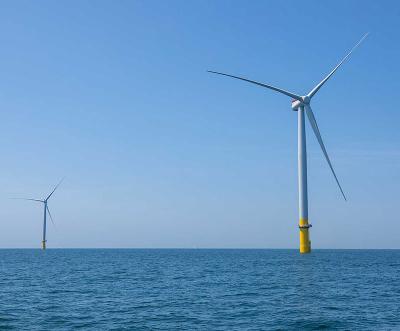
Coastal Virginia Offshore Wind (CVOW) consists of a 2-turbine pilot, which became operational in October 2020, and a 2.6 GW commercial-scale project, which is currently under construction. The pilot is located 27 miles off the coast of Virginia Beach and is the first offshore wind farm installed in federal waters and the first offshore wind project developed and owned by an electric utility company (Dominion Energy). The commercial-scale project will expand to include 176 turbines, 3 offshore substations, and 9 buried offshore export cables extending to an onshore cable landing area. The project, scheduled to be completed in 2026, is expected to generate enough electricity to power 660,000 homes.
View photos of CVOW’s construction on the BOEM CVOW Flickr page.
Location
The project is located in federal waters 27 miles off the coast of Virginia Beach, Virginia (USA).
Project Timeline
- 2025-2026: Project construction and commissioning
- March 2025: First offshore substation installed
- November 2024: 78 monopile foundations and 4 offshore substation foundations were installed
- November 2023: Transmission construction started
- 2023: BOEM Record of Decision
- September 2023: Final Environmental Impact Statement Issued
- 2022: CVOW approved by Virginia State Corporation Commission (SCC)
- 2022: Virginia State Corporation Commission review
- 2020: Pilot project turbines installed
- 2020: Construction and Operations Plan (COP) submitted to BOEM
- 2019: BOEM approves RAPR
- 2017: Submission of Research Activities Plan Revision (RAPR) for BOEM’s Review
- 2017: Ørsted retained as EPC contractor for the project
- 2017: Site assessment plan approved by BOEM
- 2013: Dominion Energy executed lease agreement with Bureau of Ocean Energy Management (BOEM)
Licensing Information
The Coastal Virginia Offshore Wind Commercial (CVOW-C) Project acquired a competitive lease on September 4, 2013, where Dominion Energy was identified as the winner of Lease Area OCS-A 0483, covering 112,799 acres located 23.5 nautical miles offshore Virginia in federal waters. In 2022, the project submitted critical permit applications, including the FAA Form 7460-1 for construction notice in April (with determinations received in May), an initial Clean Air Act Outer Continental Shelf (CAA OCS) Air Permit in March, and comprehensive Clean Water Act (CWA) and Rivers and Harbors Act (RHA) applications in May. The project received a Record of Decision from the Department of the Interior on October 31, 2023, and the Bureau of Ocean Energy Management (BOEM) provided final Construction and Operations Plan approval on January 28, 2024, authorizing the construction of 176 wind turbines and three offshore substations.
More information can be found on the BOEM Permitting & Documents page.
Key Environmental Issues
Prior to constructing the pilot turbines, more than two dozen studies and surveys were conducted to ensure protection of ocean life and avian species. The data and lessons learned from those studies are informing the development of the commercial project.
CVOW is the second facility to be studied under BOEM’s Realtime Opportunity for Development Environmental Observations (RODEO) program. RODEO aims to make direct, real-time measurements of the nature, intensity, and duration of potential stressors during the construction and initial operations of selected offshore wind facilities. Underwater acoustic monitoring was conducted during the construction of two monopile wind turbines (one with a bubble curtain and one with a double bubble curtain).
Additionally, Dominion contracted with Normandeau Associates Inc. to provide postconstruction monitoring for the pilot turbines. Normandeau's Acoustic and Thermographic Offshore Monitoring (ATOMTM) systems are deployed on platforms underneath the two turbines. They collect thermographic and natural light imagery within the rotor swept zone and the vicinity of the wind turbine 24/7 during the monitoring period. Additional ATOMTM sensors include bird and bat acoustics and VHF/MOTUS Nanotag receivers and antennae. Normandeau also conducted six boat-based surveys every other month during the first year of operations using a transect design. Additional information on this monitoring can be found here.
Environmental Papers and Reports
- Sediment-Borne Wave Disturbances and Propagation and Potential Effects on Benthic Fauna (Giordano et al. 2025)
- Interface Wave Contribution to Acoustic Particle Motion During Offshore Wind Farm Construction (Potty et al. 2024)
- Dominion Energy Coastal Virginia Offshore Wind Commercial Project: Vessel Strike Avoidance Plan (Tetra Tech Inc. 2024)
- Resource monitoring for Atlantic surfclam (Spisula solidissima) at the Coastal Virginia Offshore Wind development site (Rudders et al. 2024)
- Coastal Virginia Offshore Wind: Double Big Bubble Curtain Plan (Dominion Energy 2024)
- Will wind development adversely impact North Atlantic right whales through an increase in vessel traffic? (Bishop 2024)
- Analysis of bubble curtain effectiveness in the coastal Virginia offshore wind turbine installation (Dies et al. 2024)
- EVALUATING SOIL STIFFNESS FOR COASTAL VIRGINIA OFFSHORE WIND RESEARCH PROJECT MONOPILE FOUNDATIONS (Price 2024)
- Field Observations During Offshore Wind Structure Installation and Operation, Volume 2 (Ampela et al. 2023)
- Coastal Virginia Offshore Wind Draft Environmental Impact Statement (DEIS) (Bureau of Ocean Energy Management (BOEM) 2022)
- Passive acoustic monitoring during the construction of the Coastal Virginia Offshore Wind project (Lin et al. 2022)
- Coastal Virginia Offshore Wind Commercial Project Construction and Operations Plan (Tetra Tech Inc. 2022)
- Field Observations During Offshore Wind Structure Installation and Operation (Maryland Offshore Wind and Coastal Virginia Offshore Wind) (Amaral et al. 2021)
- Assessing the exposure of three diving bird species to offshore wind areas on the U.S. Atlantic Outer Continental Shelf using satellite telemetry (Stenhouse et al. 2020)
- Coastal Virginia Offshore Wind Noise monitoring during monopile installation A01 and A02 (WaterProof Marine Consultancy & Services BV. and Dominion Energy 2020)
- Determining Fine-Scale Use and Movement Patterns of Diving Bird Species in Federal Waters of the Mid-Atlantic United States Using Satellite Telemetry (Spiegel et al. 2017)
- Wildlife Densities and Habitat Use Across Temporal and Spatial Scales on the Mid-Atlantic Outer Continental Shelf (2012-2014) (Williams et al. 2015)
- Virginia Offshore Wind Technology Advancement Project on the Atlantic Outer Continental Shelf Offshore Virginia Revised Environmental Assessment (BOEM Office of Renewable Energy Programs 2015)
NOAA Fisheries has developed Offshore Wind Lease Reports that summarize previous fishing activity within each offshore wind lease area along the U.S. Atlantic Coast. View Descriptions of Selected Fishery Landings and Estimates of Vessel Revenue from Areas: A Planning-level Assessment and Descriptions of Selected Fishery Landings and Estimates of Recreational Party and Charter Vessel Revenue from Areas: A Planning-level Assessment for Coastal Virginia Offshore Wind (CVOW) (OCS-A-0483) here.
Environmental Monitoring: Coastal Virginia Offshore Wind (CVOW)
| Phase | Stressor & Receptor | Design and Methods | Results | Publications | Data |
|---|---|---|---|---|---|
| Baseline | Bats | Passive Acoustic Monitoring Stationary acoustic recorders on 5 structures off the coast of Virginia, across all seasons 2012-2019. | Complete Tree bat occurrence was found to be negatively related to wind speed and positively related to temperature and visibility. | True et al. 2021 | No data publicly available. |
| Baseline | Bats | Passive Acoustic Monitoring Acoustic bat detectors were deployed during offshore geophysical and geotechnical survey activities in 2020-2021 within the Lease Area. | Complete Bat activity rates were low, with no federally listed species detected. | Tetra Tech Inc. 2022 | No data publicly available. |
| Baseline | Bats | Multi-Sensor Remote Monitoring Thermal imagery cameras, ambient-light video, and ultrasonic acoustic detectors were deployed during the Coastal Virginia Offshore Wind Pilot Project (2021–2023) to monitor bat activity around wind turbines 42 km offshore. | Bat activity exhibited strong seasonal patterns, with 88.7% of observations occurring between late summer and autumn, likely associated with migration. While activity was primarily nocturnal, >30% of observations occurred during the day. Three migratory species were identified––Eastern Red Bat, Hoary Bat, and Silver-haired Bat. No collisions with turbine blades were recorded during the study. Results highlight the value of multi-sensor monitoring to understand offshore bat behavior. | Amichai et al. 2025 | No data publicly available. |
| Baseline | Birds | Digital video, boat surveys, telemetry From 2012-2014, wildlife off the Eastern Seaboard were observed with a series of digital video aerial surveys, boat surveys, satellite telemetry, and nocturnal migration monitoring. Work resulted in the Mid-Atlantic Baseline Studies (MABS). | Complete Species common to the mid-Atlantic coast were identified. | Williams et al. 2015 | No data publicly available. |
| Baseline | Birds | Satellite transmitters Peregrine Falcons and Merlins were satellite-tagged. Study by BRI at three research stations along the north Atlantic coast. | Complete Peregrine Falcons and Merlin migration routes along the Atlantic Flyway were identified. | Tetra Tech Inc. 2022 | |
| Baseline | Birds | Satellite transmitters: Telonics TAV-2630 and IMPTAV-2640 236 adult birds were tagged and tracked with Platform Terminal (satellite) Transmitters (PTTs). | Complete Fine-scale movement patterns of three species (Red-throated Loon, Surf Scoter, and Northern Gannet) were identified in the mid-Atlantic coast. | Spiegel et al. 2017, Stenhouse et al. 2020 | |
| Baseline | Birds | Digital VHF (very high frequency) transmitter tags 3,955 individuals of 17 shorebird species were tagged with VHF transmitters between 2014 and 2017 at 21 sites dispersed across North and South America. Movement was tracked via a collaborative radio telemetry network. | Complete In analysing movement of the birds through Federal waters of the Atlantic Outer Continental Shelf, most flights were found to be above the rotor swept zone (RSZ). 36% of flights were in the RSZ in fall, and 24% in spring. | Loring et al. 2021 | No data publicly available. |
| Baseline | Fish | Multibeam echo sounder, side scan sonar, visual imagery Visual imagery taken during grab samples were analysed for organisms, including fish. Surveys were undertaken using SSS and MBES in the offshore project area and cable corridor. | Complete Essential fish habitats have been designated in the project area for 33 species. Results are detailed in appendix E: essential fish habitat assessment. | Tetra Tech Inc. 2022 | No data publicly available. |
| Baseline | Invertebrates | Grab samples, digital imagery 74 grab sample stations were used to collect data. Water quality measurements were taken, and infaunal organisms were sieved and collected for identification. Underwater images were also collected to corroborate sediment grab samples. | Complete No hard bottomed habitats were observed. 26 taxa were identified, including hard clam and blue mussel in the export cable route. | Tetra Tech Inc. 2022 | No data publicly available. |
| Baseline | Marine Mammals | Protected Species Observer sighting, passive acoustic monitoring Data was collected during project-related vessel-based surveys between 2018 and 2019 in a study area encompassing the Lease Area. Additional sighting data were collected between 2020 and 2021. | Complete Marine mammals sighted are summarized in tabular form. 38 species were observed (7 large whale, 20 dolphins, 5 beaked whales, 1 porpoise, 1 manatee, and 4 seals) either seasonally or year-round. | Tetra Tech Inc. 2022 | No data publicly available. |
| Baseline | Marine Mammals | Passive acoustic monitoring Four stationary bottom-mounted recorders were deployed across the continental shelf, and six recorders were placed within the wind planning area. Data were recorded between 2015 and 2017. | Complete Right whales were found to be most common in the area, with Baleen, humpback, and fin whales also occurring. All whales occurred with seasonal variation. | Salisbury et al. 2018 | No data publicly available. |
| Baseline, Construction, Operations | Habitat Change Marine Mammals |
Spatiotemporal vessel density analysis AIS data on vessel activity from 2015–2023 were analyzed for the region surrounding the CVOW wind farm site. Monthly rasters of vessel occupancy time were created, and vessel density changes were assessed. Spatial analysis focused heavily on turbine areas and nearby export cable routes. Seasonal patterns and variance in vessel density across phases were included. Vessel density changes across categories (e.g., cargo, fishing, passenger vessels) were compared. | Complete Vessel density increased significantly during construction (+36.41 monthly hours) but dropped sharply post-construction (-33.89 monthly hours). Overall, there was a minor increase of +2.52 monthly hours between pre- and post-construction phases. Seasonal peaks occurred during summer construction months, with density returning to average levels post-construction. Passenger vessels experienced sharp fluctuations (+8.06 monthly hours during construction, -8.04 post). Stress to the right whales was negligible due to the localized and temporary nature of vessel density increases. | Bishop 2024 | No data publicly available. |
| Construction | Noise Demersal Fish, Fish |
Acoustic modeling and field measurements Impact pile driving was monitored using field measurements and acoustic modeling during the Coastal Virginia Offshore Wind construction (CVOW), focusing on substrate-borne particle motion and its potential impacts on benthic fish species. | Complete Field data demonstrated that substrate-borne particle acceleration levels exceeded the behavioral sensitivity thresholds of benthic fish species such as Atlantic Cod and Plaice, at ranges up to 1.5 km from the pile driving site. Results underscore the necessity of further studies to assess long-term behavioral and physiological impacts of pile-driving noise on demersal fish populations. | Giordano et al. 2025 | No data publicly available. |
| Construction | Habitat Change Invertebrates |
Atlantic surfclam (Spisula solidissima) monitoring The 2024 Surfclam Survey evaluated surfclam abundance, distribution, and population structure using a hydraulic dredge at 38 stations in lease and control areas. CPUE, biomass, and fishable biomass were estimated via swept area calculations and dredge efficiency (0.65). Age analysis used shell rings with a von Bertalanffy growth model, while genetic testing identified S. solidissima and S. similis distributions. A Petersen grab sampler collected sediment and juveniles, and a Castaway CTD recorded bottom temperature and salinity. Bycatch species were also documented. | Complete The 2024 Surfclam Survey found high biomass but low exploitable biomass within the CVOW lease area, with biomass highest in the south and 50 times lower in the north. Recruitment was consistent over the past 5–6 years, but older surfclams (>6 years) were absent, suggesting lower survival. Genetic analysis showed a mix of S. solidissima and S. similis, with S. similis more common in warmer, shallower waters. Juvenile surfclams were present in all areas, indicating recent recruitment. Environmental data showed minor temperature and salinity differences, unlikely to explain biomass patterns. | Rudders et al. 2024 | No data publicly available. |
| Construction | Noise Marine Mammals |
Passive acoustic monitoring A suite of hydrophone arrays was deployed to monitor pile driving sound and seafloor particle motion during construction of two wind turbine towers in the Coastal Virginia Offshore Wind (CVOW) project in May 2020. The primary objective of this passive acoustic monitoring (PAM) work was to assess the effectiveness of bubble curtains for underwater noise mitigation. | Complete PAM data showed that the bubble curtain effectively reduced the pile driving noise above 200 Hz, and a significant azimuthal dependency was observed. Statistical analyses of pile driving noise will be presented, along with recommendations for future wind farm construction monitoring, especially on marine mammal acoustic monitoring during construction. | Lin et al. 2022 | No data publicly available. |
| Operations | Noise | Operational Sound Operational sound was measured between Dec. 14, 2021, and Feb. 2, 2022, using a Geosled equipped with a tetrahedral hydrophone array and two Several Hydrophone Recording Units (SHRU). Additionally, two Ocean Bottom Seismometers were deployed. | Complete Underwater noise levels recorded during turbine operations were relatively low, ranging from 120 to 130 dB re 1 μPa except during storms when the received levels increased to 145 dB re 1 μPa. Operational phase sound levels were substantially higher (10 to 30 dB) than those previously recorded at the Block Island Wind Farm (BIWF) at frequencies below approximately 120 Hz. | Ampela et al. 2023 | No data publicly available. |
| Operations | Noise Marine Mammals |
Underwater Sound Monitoring A suite of hydrophone arrays was deployed to monitor pile driving sound and seafloor particle motion during construction of the two pilot project turbines. The primary goal was to evaluate the efficacy of bubble curtains deployed around the turbine. The arrangement of the passive acoustic monitoring also allowed studies of azimuthal and range dependencies of pile driving sound propagation. | Complete Data showed the bubble curtain effectively reduced pile driving noise above 200Hz, and a significant azimuthal dependency was observed. | Lin et al. 2022, Amaral et al. 2021, WaterProof Marine Consultancy & Services BV. and Dominion Energy 2020 | No data publicly available. |