Description
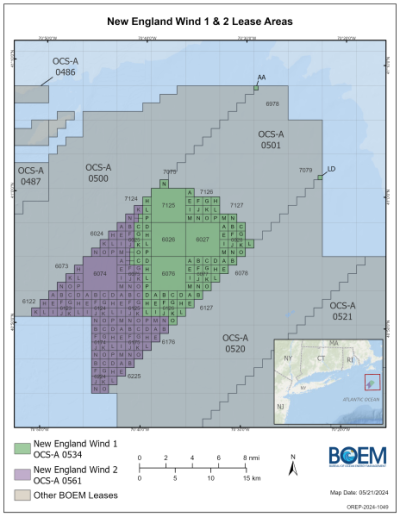
New England Wind 1, formerly known as Park City Wind, together with New England Wind 2, formerly known as Commonwealth Wind, will form part of a 1,870 MW wind farm complex. New England Wind 1 will have an installed capacity of 791 MW and New England Wind 2 will have an installed capacity of 1.1+ GW. On May 15, 2024, the New England Wind project was segregated into two leases, New England Wind 1 (OCS-A 0534) and New England Wind 2 (OCS-A 0561).
Location
The New England Wind project will be located about 20 nautical miles (nm) from the southwest corner of Martha’s Vineyard, Massachusetts, and about 24 nm from Nantucket, Massachusetts.
New England Wind 1 (leased by Park City Wind, LLC) will be located 37 km off the coast of Massachusetts. It will export power via two export cables which will make landfall in the town of Barnstable, Massachusetts and will have a grid connection location of West Barnstable Station.
New England Wind 2 (leased by Commonwealth Wind, LLC) will be located 23 km off the Massachusetts coast. It will have a grid connection location of Barnstable, Massachusetts.
Project Timeline
- 2027, December: Anticipated to be Fully Commissioned
- 2026, January: Anticipated Onshore and Offshore Construction Start
- 2024, July: Construction and Operations Plan (COP) approved
- 2024, May: New England Wind segregated into New England Wind 1 (OCS-A 0534) and New England Wind 2 (OCS-A 0561)
- 2024, April: Record of Decisions (ROD) approved
- 2024, February: Final Environmental Impact Statement (FEIS) available
- 2022, December: Draft Environmental Impact Statement (DEIS) published by BOEM
- 2022, December: NMFS ESA Consultation Anticipated
- 2022, September: NMFS ESA and EFH Consultation Packages Submitted
- 2022, June: Development of Regional Impact Review Applications Filed with Cape Cod Commission (Barnstable County) and Martha’s Vineyard Commission
- 2022, April: Addendum to Construction and Operations Plan (COP) Filed
- 2021, December: Revised Construction and Operations Plan (COP) Filed
- 2021, June: Revised Construction and Operations Plan (COP) Filed
- 2021, June: NEPA Environmental Review Initiated
- 2020, July: Construction and Operations Plan (COP) Filed
- 2018, May: Offtake Conditionally Secured
- 2017, March: Site Assessment Plan (SAP) Submitted
- 2015, January: Site Exclusivity Obtained
Licensing Information
The lead permitting agency, the Bureau of Ocean Energy Management (BOEM), approved the Construction and Operations Plan (COP), Record of Decision (ROD), and Final Environmental Impact Statement (FEIS) in 2024, during which the project was segregated into two leases. Other federal agencies involved in the permitting included the U.S. Army Corps of Engineers, U.S. Environmental Protection Agency, and National Oceanic and Atmospheric Administration Fisheries (NOAA) National Marine Fisheries Service (NMFS). State agencies involved in the permitting included the Massachusetts Department of Environmental Protection, the Massachusetts Environmental Policy Act (MEPA), Massachusetts Division of Fisheries and Wildlife, Massachusetts Board of Underwater Archaeological Resources, Massachusetts Department of Public Utilities, and Massachusetts Energy Facilities Siting Board. The project name changed from Vineyard Wind South to New England Wind in 2021.
Key Environmental Issues
- 2025, June: The Wampanoag Tribe of Gay Head (Aquinnah), along with environmental groups and fishing charter businesses, filed a lawsuit against the federal agencies (March 2025: ACK for Whales filed a petition with the U.S. EPA, requesting the agency rescind the Clean Air Act permit it granted to New England Wind to construct and operate its offshore wind farm) that approved the project over concerns about the environment and marine mammals, claiming they violated multiple environmental laws when issuing a Record of Decision (ROD) for the offshore project
- 2025, March: ACK for Whales filed a petition with the U.S. EPA, requesting the agency rescind the Clean Air Act permit it granted to New England Wind to construct and operate its offshore wind farm.
- 2025, April: Barnstable-based group Save Greater Dowses Beach petitioned the EPA to conduct an additional review for the already approved project, citing concerns an expanded substation on land could harm the aquifer – the community’s source of drinking water.
- 2025, May: ACK for Whales, Green Oceans, charter fishing groups and the Wampanoag Tribe of Gay Head (Aquinnah) sued the federal government; they are asking the court to vacate agency approvals for the project.
- 2022, December: The Final Environmental Impact Statement (EIS) assessed foreseeable impacts on physical, biological, socioeconomic, and cultural resources that could result from the construction and installation (construction), operations and maintenance (operations), and conceptual decommissioning (decommissioning) of a commercial-scale offshore wind energy facility and transmission cable to shore known as the New England Wind Project.
- 2022, December: The Cumulative Historic Resources Visual Effects Assessment for the New England Wind 1 & 2 was conducted using cumulative viewshed models to help inform how the presence of wind turbine generators associated with the proposed project and other offshore wind projects would affect seven historic properties on Martha’s Vineyard and Nantucket. The assessment found that cumulative effects of the proposed project and other offshore wind projects would further adversely affect the setting of the historic properties, particularly Gay Head Lighthouse; however, the degree to which offshore wind projects would affect the significant characteristic of the undeveloped ocean view is small relative to the other aspects of the properties’ integrity that remain intact. Accordingly, development of the proposed project and other offshore wind projects in the Rhode Island/Massachusetts lease areas would not affect the integrity of any of the historic properties to the extent that it would make them ineligible for the National Register of Historic Places.
Environmental Papers and Reports
- New England Wind Record of Decision (ROD) (Bureau of Ocean Energy Management 2024)
- New England Wind Final Environmental Impact Statement (FEIS) (BOEM Office of Renewable Energy Programs 2024)
- New England Wind (OCS-A 0534) Construction and Operations Plan (COP) (Epsilon Associates Inc. 2024)
- New England Wind Demersal Trawl Survey Annual Report 534 Lease Area 2021/2022 Annual Report (Rillahan and He 2023)
- Cumulative Historic Resources Visual Effects Assessment (Bureau of Ocean Energy Management 2022)
- New England Wind Demersal Trawl Survey Winter 2022 Seasonal Report 534 Study Area Progress Report #10 (Rillahan and He 2022)
- New England Wind Draft Environmental Impact Statement (DEIS) (BOEM Office of Renewable Energy Programs 2022)
- New England Wind (OCS-A 0534) Construction and Operations Plan (Epsilon Associates Inc. 2022)
- Vineyard Wind Site Assessment Plan (Vineyard Wind 2018)
NOAA Fisheries has developed Offshore Wind Lease Reports that summarize previous fishing activity within each offshore wind lease area along the U.S. Atlantic Coast. View Descriptions of Selected Fishery Landings and Estimates of Vessel Revenue from Areas: A Planning-level Assessment and Descriptions of Selected Fishery Landings and Estimates of Recreational Party and Charter Vessel Revenue from Areas: A Planning-level Assessment for New England Wind (OCS-A-0534) here.
Environmental Monitoring: New England Wind 1 and 2
| Phase | Stressor & Receptor | Design and Methods | Results | Publications | Data |
|---|---|---|---|---|---|
| Baseline | Fish | Video Surveys and Simulations Seasonal video and trawl surveys were conducted in the New England Wind project area in 2020 and 2021. Simulations of typical and maximum impact cable installation methods in the project area were utilized. | Complete Overall, impacts to essential fish habitat (EFH) in the project development area are anticipated to be short-term and localized during construction and installation of New England Wind. Temporary noise from pile driving could potentially impact all species with EFH during construction. The use of a soft start during pile driving will give fish in the area time to avoid the noise source before full impact strikes are made. Sound reduction technologies will be used to minimize impacts. | Epsilon Associates Inc. 2022 | No data publicly available |
| Baseline | Fish, Marine Mammals, Reptiles | Acoustic Assessment and Analysis To estimate potential effects to marine fauna from anthropogenic sound generated during New England Wind pile installation, the following modeling steps were used: 1. Modeled the spectral and temporal characteristics of the sound output from the proposed pile driving activities using the industry; 2. Acoustic propagation modeling that combined the outputs of the source model with the spatial and temporal environmental context to estimate sound fields; 3. Animal movement modeling integrated the computed sound fields with species-typical behavioral parameters to estimate received sound levels for the modeled animals that may occur in the operational area; 4. Estimated the number of potential injurious and behavioral level exposures based on pre-defined acoustic thresholds/criteria. | Complete The endangered North Atlantic right whale is predicted to experience fewer than four injurious exposures during the combined installation of Phases 1 and 2 of the New England Wind project. Fewer than one sea turtle is predicted to be exposed to sound levels exceeding injury threshold. Acoustic results indicate that ranges to potential injury for fish with swim bladders not involved in hearing are small. | Epsilon Associates Inc. 2022 | No data publicly available |
| Baseline | Invertebrates | Grab Sampling and Analysis and Underwater Video Benthic grab samples were collected within the New England Wind project area on from 2016, 2017, and 2020. Sample analysis (and quality control) were conducted. Underwater video surveys were conducted in 2018. Grab sampling and video surveying methods were implemented in the 2019 survey. | Complete In 2016, the benthic community consisted of polychaete worms, bivalve mollusks, nematode roundworms, nemertean ribbon worms, common sand dollars, and crustaceans including amphipods, cumaceans, ostracods, and isopods. In 2017, the most abundant taxon was Nematoda, followed by Caprellidae, Tellinidae, and Oligochaetes. The 2018 survey found the more complex and species rich habitats tend to be found within the higher currents of Muskeget Channel. In 2019, sampling locations consisted of muddy sand, sand, or sandy mud. Infaunal structures, burrows, macrofauna, and shells made up most of the remaining surface area. Sea stars were the dominant benthic macrofauna. Infauna was dominated by the Arthropoda phylum followed by the Annelida phylum. | Epsilon Associates Inc. 2021 | No data publicly available |
| Operations | Displacement Birds |
Bird Protection Plan Piping Plover protection plan that addresses measures to protect state-listed species and their habitats during the nesting season (April 1 – August 31) and a contingency plan in the event problems arise during the HDD cable installation. Monitoring intensity will increase with increasing proximity of nests and/or chicks relative to the work zone, and will also increase with increasing frequency of chick observations. | Planned Results pending | Epsilon Associates Inc. 2022 | No data publicly available |
| Operations | Habitat Change Physical Environment |
Benthic Monitoring Plan Six habitat zones in the New England Wind project area will contain two randomly placed benthic monitoring sites. At each site, video and multibeam echo sounder surveys will be performed, with the long axis oriented perpendicular to the easternmost export cable and the short axis oriented parallel to the cable alignment. Four grab stations will be sampled along a gradient extending east from the impact area. Stations will be positioned within the impact area immediately adjacent to the impact source. Three control stations will be located an additional approximately 0.6 miles (1 km) to the east in an area with similar physical and environmental characteristics. At each control station, three replicate grabs and 330 feet (100 m) of underwater video will be collected. | Planned Results pending | Epsilon Associates Inc. 2022 | No data publicly available |